Route 66 - Roadmap - Oklahoma - Part 2 (turn by turn)
The following towns you pass through on Route 66 through Oklahoma
Quapaw – Commerce – Miami – Narcissa – Afton – Vinita – White Oak – Chelsea – Foyil – Sequoyah – Claremore – Verdigris – Catoosa – Tulsa – Oakhurst – Sapulpa – Kellyville – Heyburn – Bristow – Depew – Stroud – Davenport – Chandler – Warwick – Wellston – Luther – Arcadia – Edmond – Oklahoma City – Bethany – Yukon – El Reno – Weatherford – Clinton – Foss – Canute – Elk City – Sayre – Erick – Texola
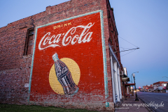
Stroud – Davenport – Chandler
Behind Depew you turn again left into Route 66. Follow the road up to Stroud. Through the village leads the route 66, and behind Stroud it goes curvy further to Davenport. Davenport is an old town with a old bricked main street. Follow of Route 66 to Chandler.
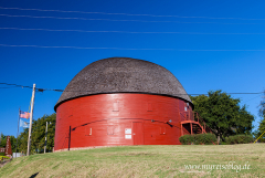
Warwick – Wellston – Luther – Arcadia
U.S. 66 runs through the town Chandler behind the railway bridge, follow U.S. 66 to Warwick. In Warwick is a Motorcycle Museum on the corner. Follow the U.S. 66 to Wellston and trough Luther. The street is now called OK-66-BR. Just before Luther turn into 2nd Street and drive through the town. Behind Luther follow again the OK-66, you reach Arcadia, OK. In Arcadia is the famous “Round Barn” and at the end of the village is “Pop’s on Route 66”, the largest Sodabottle of the world.

Edmond – Oklahoma City – Bethany
Behind Arcadia follow OK-66 and drive across I-35 . Follow OK-66, then, just before you cross one more time I-35, take US-77 just before Edmond. U.S. 77 leads to Oklahoma City. Visit here the State Capitol of Oklahoma. U.S. 77 crosses the OK-66/I-44, follow this to the right towards Bethany, OK.
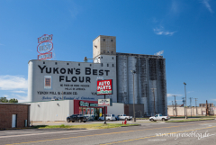
Yukon – El Reno – Weatherford – Clinton
Behind Bethany follow the Overholser Drive, where you cross the Canadian River over an old bridge. Follow after the crossing beneath the turnpikes of 36th Street and turn at the end of the road back onto OK-66 (E Main Street). This route is well signposted as any other in Oklahoma. Further along the OK-66 reach you Yukon. Behind Yukon follow OK-66 to El Reno. Cross the Shepard Avenue, follow a right turn following the Rock Iceland Ave (OK-66 West, U.S. 81 North, Business Loop 40 West) In El Reno, it is easiest to follow the brown signs for Route 66. This always leads you along Route 66 past the attractions. Behind El Reno follow the E1020 always parallel to I-40 to Weatherford. Behind the village follow the Frontage Road to Clinton.
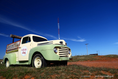
Foss – Canute – Elk City
In Clinton drive onto 10th Street, then follow the Commerce Road, then follow on the E1060, parallel I-40th. Under Cross the I-40, drive behind left again parallel the interstate, this route is well signposted. One over-or under crossed every now and then I-40, and then continue to drive on this track right or left on the Frontage Road. You reach Elk City, here follow the Business Loop I-40 through the town.
Sayre – Erick – Texola
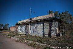
In Elk City, there is a Route 66 Museum on Business Loop 40 The brown signs lead you through the village. Follow the State Highway 66 (I-40B / Hwy 34). Turn then on N1900, which is again a parallel Frontage Road of I-40. You reach the village of Sayre. In Sayre bending into the 4th Street and follow the I-40B Loop or the U.S.-283. Behind the village after crossing the river ascend into the El Camino Road and then onto North Frontage Road. The next town is Erick. The Roger Miller Boulevard runs through the town. Erick is worth a stop. Follow behind Erick the SR-30 West to Texola, a ghost town on the border with Texas.
Sapulpa, Oklahoma- Texola, Oklahoma
Bigger map
The Route 66 in Oklahoma is 432 miles or 695 km long
All data I give to you has been researched to the best of my knowledge and belief. Nevertheless, to me, of course, be a mistake. In addition to my information, please use always current maps or guidebooks.
